
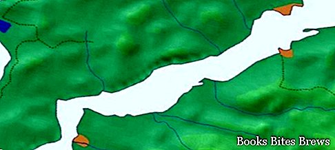
The Strait of the Dardanelles, which connects the Marmara Sea with the Aegean Sea, is about 62 kilometers long and has a variable width between about 1200 and 8000 meters.
General information Strait of the Dardanelles
In ancient times it was called Ellesponto and today together with the Bosphorus strait it marks the border between Europe and Asia.
Thanks to its strategic position, in the past it was the scene of many battles between the various contenders.
From 20 July 1936 the passage through this strait has been regulated by the Montreux Convention, an agreement between France, Turkey, Bulgaria, Japan, Greece and the Soviet Union.
With this agreement, the complete freedom of navigation of merchant ships of any flag in peacetime was established, while in the event of war, transit would be limited to ships flying the flag of countries not in conflict with Turkey, informing the Turkish government at least 8 days before of the passage.
Control over the Strait of the Dardanelles in 1946 was one of the causes of the cold war between the United States, which supported Turkey, and the Soviet Union.


