
The Transantarctic Mountains are a mountain range located in Antarctica that develop between Cape Adare, which is located north of Terra Vittoria, and the land of Coats for a length of about three thousand five hundred kilometers.
Information Transantarctic Mountains
These mountains also include minor mountains including those of Horlick, Thiel, Pensacola, Shackleton and Theron.
The mountain ranges of the Antarctic Peninsula are commonly assimilated to the Transantarctic mountains, still extending the total length to four thousand eight hundred kilometers.
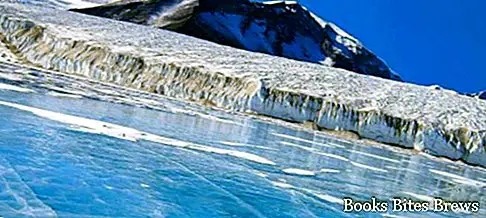
Fryxell lake, located in the Transantarctic mountains, is formed by the water generated by the melting of the glacier.
With the crossing of the continent from the Ross Sea to the Weddell Sea they reach heights that go beyond four thousand five hundred meters above sea level with peaks largely covered in ice.
In the vicinity of the Bay of McMurdo there are the Dry Valleys of McMurdo which, being valleys without ice and with little rainy phenomena, represent an exception from the environmental point of view compared to the rest of the continent.
The highest mountain in the Transantarctic mountains is Mount Kirkpatrick with its 4,528 m altitude.
Capo Adare, where among other things many penguins have their natural environment, separates the Ross sea from the Antarctic seas and in its hinterland there are the Admiralty Mountains famous for being one of the landing places for expeditions in Antarctica.
The region of Antarctica called Terra Vittoria is located south of New Zealand and owes its name to James Clark Ross who wanted to give it to him to honor the English Queen Victoria.
The Land of Coats is found along the east coast of the Weddell Sea.
The Ross Sea can be described as being a deep bay located in Antarctica at the geographically located point between Queen Victoria's Land and Marie Byrd's Land.
Recommended readings- What are latitude and longitude, how are they calculated
- Antarctica: information, territory, Antarctic oasis
- What are the tallest skyscrapers in the world
- How to easily whitewash a room in the house
- How to make the perfect turn-ups for pants
Due to the extremely cold temperatures, a part of the surface that exceeds half of the total is permanently covered by a slab of ice of generous thickness which is also called the Ross barrier with an area of about half a million square kilometers.
This sea was named after the discoverer James Clark Ross.
Compared to the sea of Ross, the island of Ross is located to the west with the active volcano Mount Erebus while to the east, enclosed in an inlet, there is the bay of McMurdo which during the Antarctic summer forms a natural port being free from ice.
Due to strong storms, polynas are formed in the sea which are large surfaces of water where the surface ice has opened up giving the penguins of the area nourishment.


