
When does the first geographical map that represents the arrangement of the emerged lands and oceans with sufficient realism date back to?
First geographical map in history
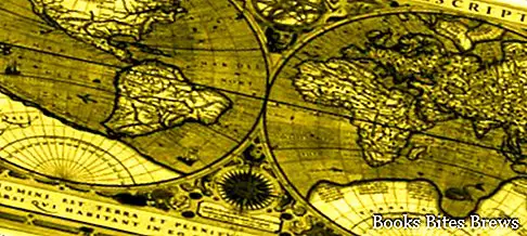
Since ancient times men have tried to draw maps of the world, but these did not look at all like the cards we are used to seeing today.
In ancient times, in fact, there was no knowledge of the existence of the American continent and Antarctica.
The maps that were made did not therefore include this part of the world.
The first maps resembling the real ones were drawn from the 16th century, coinciding with the beginning of navigation around the world.
One of the best is considered that of Mercatore, a Flemish cartographer who had the merit of developing, in 1568, the technique of cartographic projections.


